RealMapInfo LLC Provides Data-Driven Solutions for Land Surveys
Get accurate land survey plot plan and property boundary survey with RealMapInfo LLC. Trusted experts for reliable, data-driven land surveying services.
NEWTON, MA, UNITED STATES, September 25, 2025 /EINPresswire.com/ -- RealMapInfo LLC has announced the availability of its data-driven solutions for land surveying projects, emphasizing precision, reliability, and advanced technological integration. The company offers a comprehensive range of services designed to support residential, commercial, and municipal land surveying requirements across Massachusetts.Professional Land Surveying Services for Diverse Needs
RealMapInfo LLC provides professional land surveying services that combine modern equipment with established techniques. These services are tailored to accommodate a variety of property types, including residential lots, commercial sites, and public land projects. By integrating geographic data, GPS technology, and traditional surveying methods, the company ensures accurate measurements and reliable results for each project.
Property Boundary Survey Ensures Accuracy
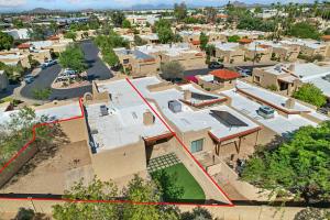
A central component of RealMapInfo LLC’s offerings is the property boundary survey. This service is designed to define precise property lines, which are critical for legal documentation, construction planning, and property transactions. Surveyors analyze historical records, physical markers, and geospatial data to create a clear delineation of boundaries, helping property owners and developers make informed decisions.
Land Survey Plot Plan for Development and Planning
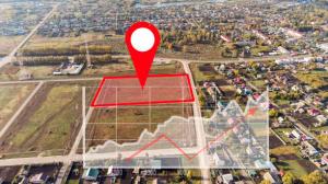
The company also produces land survey plot plans that provide detailed visual representations of property layouts. These plans include dimensions, easements, setbacks, and other key data, supporting architects, builders, and municipal authorities in planning and construction. Plot plans serve as a foundation for building permits, zoning approvals, and infrastructure development, ensuring compliance with local regulations.
Integration of Modern Technology in Surveying
RealMapInfo LLC applies cutting-edge technology to enhance the precision and efficiency of surveying projects. Tools such as GPS mapping, laser scanning, and digital data management allow surveyors to capture accurate measurements while minimizing human error. This combination of technology and expertise ensures that clients receive results that are both reliable and actionable.
Residential Surveying Services for Property Owners
For homeowners and private property investors, RealMapInfo LLC offers a range of residential services. Property line verification, lot division, and certified plot documentation provide clarity for property ownership and development projects. By addressing the specific needs of residential clients, the company helps prevent disputes and supports well-informed property management.
Commercial Surveying Services for Developers and Businesses
In the commercial sector, RealMapInfo LLC supports developers, contractors, and corporate clients with detailed surveying solutions. Services include site analysis, topographic surveys, and boundary verification. These insights assist in planning construction, managing land resources, and ensuring compliance with local zoning and environmental regulations. Commercial clients benefit from comprehensive reports that provide the data needed for strategic decision-making.
Certified Plot Plans for Legal and Regulatory Requirements
Certified plot plans provided by RealMapInfo LLC serve as official documents for municipal authorities and legal processes. These plans document property boundaries, improvements, and easements in a formal, verifiable format. By preparing certified documents, the company supports clients in property transfers, construction approvals, and dispute resolution with accurate and legally recognized data.
Digital Services Streamline Surveying Projects
Digital integration is a key aspect of RealMapInfo LLC’s methodology. By converting survey data into digital formats, clients gain easy access to maps, charts, and reports. These digital services allow for efficient sharing with stakeholders, incorporation into design software, and long-term record keeping. The approach combines precision with accessibility, enabling clients to use data effectively for planning and project management.
Commitment to Accuracy and Reliability
The company’s experienced team ensures that every project meets high standards of accuracy and reliability. Surveyors conduct thorough field assessments, cross-reference historical records, and verify all measurements before finalizing reports. This attention to detail minimizes errors and ensures that clients receive dependable results for residential, commercial, and municipal projects.
Specialized Property Line Surveying
Property line surveying is a core specialty of RealMapInfo LLC. These surveys provide clarity for property ownership, construction planning, and potential boundary disputes. By identifying precise boundaries, the company helps property owners understand the extent of their land and facilitates informed decisions related to development, leasing, or sale.
Experienced Team Led by Todd P. Chapin
Founded in 2010 by Todd P. Chapin, RealMapInfo LLC brings over 35 years of professional experience to the field of land surveying. Chapin has completed thousands of projects across eastern Massachusetts, applying both practical knowledge and technological advancements. Under his leadership, the company has built a reputation for reliability, precision, and methodical project execution.
Comprehensive Land Surveying Services
The company’s offerings span a wide range of services including topographic surveys, boundary verification, construction staking, and mapping. These services cater to diverse client needs, providing essential information for construction, land development, legal documentation, and property management. RealMapInfo LLC combines technical expertise with practical insight to deliver results that are both precise and actionable.
Focus on Client Understanding and Project Planning
RealMapInfo LLC emphasizes clear communication and collaboration with clients. By explaining survey findings, clarifying technical details, and providing visual documentation, the company ensures that clients understand project outcomes. This approach supports informed decision-making, reduces the risk of disputes, and helps property owners and developers plan future projects with confidence.
Advancing Precision in Land Surveying
RealMapInfo LLC’s data-driven approach underscores its role as a reliable partner for land surveying projects. Through professional land surveying services, property boundary surveys, and land survey plot plans, the company delivers accurate, accessible, and actionable data. With a commitment to precision, technology integration, and regional expertise, RealMapInfo LLC supports property owners, developers, and municipal authorities in achieving reliable results for every land project.
About RealMapInfo LLC
RealMapInfo LLC, licensed under Massachusetts license #37558, was founded by Todd P. Chapin in 2010. With more than 35 years of experience, the company provides comprehensive land surveying services, including property line surveying, certified plot plans, digital solutions, and commercial surveying across Marlborough and surrounding areas. The company combines technology and traditional methods to ensure precise and reliable results for all clients.
Media Contact:
RealMapInfo LLC
Address: 275 Grove Street, Suite 2-400, Newton, MA 02466
Phone: 774-570-0642
Email: info@realmapinfo.com
Website: www.realmapinfo.com
RealMapInfo LLC
RealMapInfo LLC
+1 774-570-0642
Info@realmapinfo.com
Legal Disclaimer:
EIN Presswire provides this news content "as is" without warranty of any kind. We do not accept any responsibility or liability for the accuracy, content, images, videos, licenses, completeness, legality, or reliability of the information contained in this article. If you have any complaints or copyright issues related to this article, kindly contact the author above.


